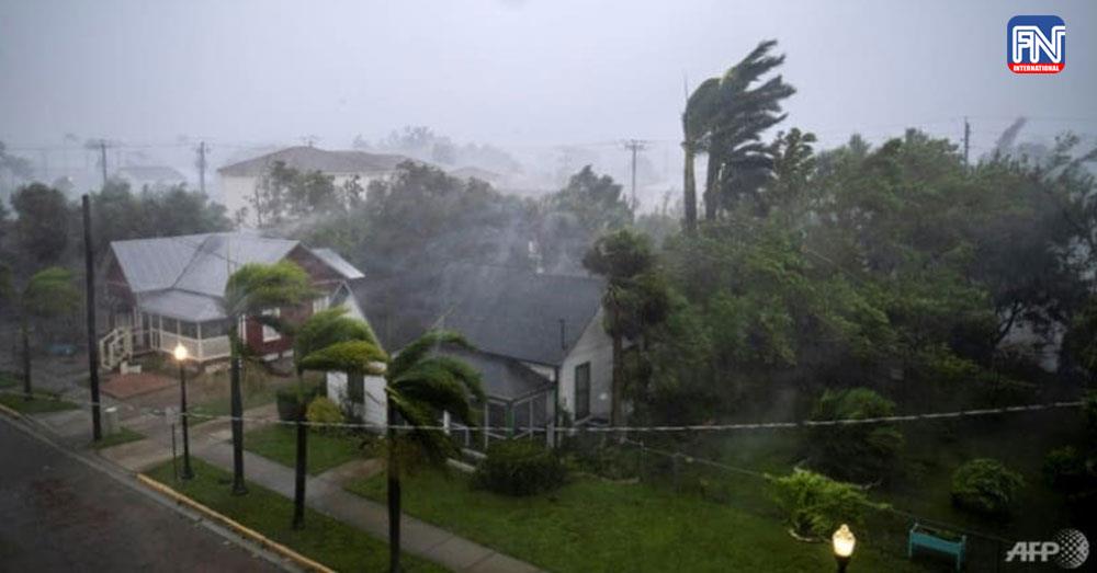

VENICE, Sept 28 (Reuters) - Hurricane Ian plowed into Florida's Gulf Coast with catastrophic force on Wednesday, unleashing howling winds, torrential rains and a treacherous surge of ocean surf that made it one of the most powerful U.S. storms in recent years.
Crashing ashore as a Category 4 hurricane with sustained winds of up to 150 miles per hour (241 kph), Ian quickly transformed an idyllic stretch of sandy beaches and coastal towns into a disaster zone inundated by seawater.
Early video images of the storm's fury on local TV and social media showed floodwaters nearly reaching rooftops in some communities, sweeping away cars and the ruins of homes as palm trees were bent almost in half.
Up to 2 feet (60 cm) of rain is forecast to fall on parts of central Florida as the storm moves inland, threatening to cause extensive flash floods.
"This storm is doing a number on the state of Florida," said Governor Ron DeSantis, who asked U.S. President Joe Biden to approve a major federal disaster declaration providing a wide range of U.S. emergency aid to the entire state.
U.S. border authorities said 20 Cuban migrants were missing after their boat sank off the Florida coast as Ian neared the coast on Wednesday.
There were no immediate official reports of other storm-related casualties.
An unknown number of people were stranded in "high-risk" evacuation zones and in need of help after defying orders to seek higher ground, but rescue crews were unable to immediately reach them, the governor said.
Having swept past Cuba on Tuesday, leaving it without power for hours, Ian made landfall in Florida at 3:05 p.m. EDT (1905 GMT) on Wednesday near Cayo Costa, a barrier island just west of Fort Myers, the U.S. National Hurricane Center (NHC) reported.
The storm's peak wind speeds put it just shy of a Category 5 designation on the Saffir-Simpson scale, the maximum classification.
Ian then moved ashore on Florida's mainland, south of the harborside town of Punta Gorda, with slightly diminished winds topping out at 145 mph.
DeSantis said Ian had generated life-threatening storm surges - waves of wind-driven seawater rushing in along the coast - of up to 12 feet (3.7 meters) in some places. Forecasters also warned of intense thunderstorms and possible tornadoes.
"This is a storm that we will talk about for many years to come, an historic event," said Ken Graham, director of the National Weather Service.