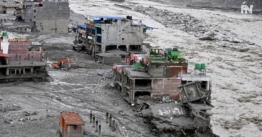

(Phnom Penh): When people think about melting glaciers, they often think of rising sea levels or ice turning into water. But the disaster that struck Nepal on August 26, 2026, highlighted another potential danger: as mountain glaciers melt, thin and retreat, the risks may not come from meltwater alone. They may also involve changes in the stability of ice, rock and entire mountain slopes.
The Nepal disaster began with a massive slope failure involving ice and rock in the Langtang Lirung area. The collapsing mass plunged into the valley, generating a debris flow and flooding that traveled nearly 100 kilometers through the river system. The collapse was powerful enough to generate seismic waves with energy equivalent to approximately a magnitude-5.2 earthquake.
The event has raised a major scientific question: As the world warms and mountain glaciers continue to melt, thin and retreat, could these changes make mountain slopes more unstable and increase the future risk of ice-rock collapses and downstream flooding?
The question has gained further attention after Nepal’s Foreign Minister Shisir Khanal described the disaster as a “warning sign” of the risks posed by climate change and called on the international community to treat warming in the Himalayas as an urgent concern. Scientifically, however, it has not yet been established that climate change was the direct trigger of the August 26 disaster.
Melting Glaciers Do Not Produce Only “Water”
Mountain glaciers are not isolated blocks of ice sitting independently on mountains. They are part of a complex natural system in which ice, rock, soil, water and temperature interact.
As temperatures rise, glaciers can melt, thin and retreat. Meltwater can penetrate cracks and reach areas beneath the ice. At the same time, permafrost — ground and rock that have remained frozen for long periods — can warm, thaw and weaken, potentially reducing the stability of some mountain slopes.
Evidence from the Hindu Kush Himalaya shows that these changes are occurring at a significant pace. A March 2026 report by the International Centre for Integrated Mountain Development (ICIMOD) found that the rate of ice loss in the region has roughly doubled since 2000.
Between 1990 and 2020, glaciers in the region lost about 12 percent of their surface area and an estimated 9 percent of their ice volume. Long-term observations also show that, at sites with continuous monitoring, cumulative ice-thickness losses have reached as much as approximately 27 meters since 1975.
Nepal’s Lesson: Glacial Lakes Are Not the Only Threat
A study published in Nature Communications estimated that around 15 million people worldwide are exposed to potential impacts from glacial lake outburst floods, with approximately 62 percent of those at risk living in High Mountain Asia.
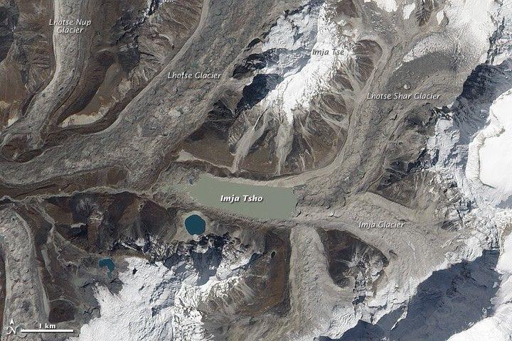
Scientists and authorities across the Himalayas have therefore devoted considerable attention to Glacial Lake Outburst Floods (GLOFs). Such disasters can occur when glacier meltwater accumulates in a lake and the natural barrier holding the water back fails or becomes unstable, allowing a large volume of water to rush rapidly downstream.
But the Nepal disaster showed that a major catastrophe does not necessarily have to begin with a glacial lake.
Before the August 26 event, there was no evidence of a large glacial lake at the source area that was on the verge of bursting. Instead, the disaster began with a rapid slope failure involving ice and rock, which subsequently generated a debris flow and downstream flooding.
The lesson is important: monitoring systems focused primarily on glacial lakes may not be sufficient. Scientists may also need to pay much closer attention to ice- and rock-covered mountain slopes and their stability.
Can a Mountain Show Warning Signs Before It Collapses?
One of the most significant findings to emerge after the Nepal disaster concerns what happened before the collapse.
Analysis of satellite imagery taken before the event identified several unusual changes in the source area. The images showed changes on the ice surface and accelerating movement of ice and rock down the mountain slope — possible indications that the system was becoming unstable. Researchers also observed cracks and changes associated with meltwater in the area.
This does not mean scientists can yet predict the exact day or hour when a mountain slope will collapse.
But it raises an important possibility: if satellites can detect abnormal acceleration, new cracks or other changes in glaciers and mountain slopes, could those signals be used to identify high-risk areas and intensify monitoring before disaster strikes?
Emerging evidence suggests that this may be possible.
How Could Satellites and AI Help?
The Himalayas cover a vast area, with thousands of glaciers, many located at high elevations in remote and difficult-to-access terrain. It is therefore impossible to install ground-based monitoring equipment on every glacier.
The scale of the challenge is striking. The Hindu Kush Himalaya contains more than 63,700 glaciers, yet the Glacier Outlook 2026 relied on long-term observational data from only 38 glaciers. Of those, just seven met the criteria for long-term reference-glacier monitoring under standards used by the World Glacier Monitoring Service.
The numbers illustrate the enormous monitoring gap across the region — and why satellite observation and advanced data analysis could become increasingly important.
Satellites can monitor changes across vast mountain areas from space, while artificial intelligence can help analyze large volumes of satellite imagery to identify unusual patterns. These might include accelerating movement of ice and rock down a slope, the appearance of new cracks or other changes requiring closer scientific attention.
Experience from previous glacier collapses has shown that ice and rock on some mountain slopes can begin moving increasingly rapidly before a major failure occurs.
Satellites combined with AI could therefore become valuable tools for identifying potential hazard zones, prioritizing areas for closer monitoring and supporting early-warning systems in the future.
Infrastructure Must Look Upstream — All the Way to the Mountains
The Nepal disaster also demonstrated that risk assessments for hydropower dams, roads, bridges and communities cannot focus only on the immediate locations where infrastructure is built.
Assessments may need to extend tens of kilometers upstream. Are there glaciers above? Are there unstable rock slopes? Are potentially dangerous glacial lakes present? And if a rapid ice-rock avalanche occurs, how far could the resulting chain of hazards travel?
The importance of the region extends far beyond the mountaintops. According to ICIMOD, the snow, ice and permafrost systems of the Hindu Kush Himalaya are linked to the livelihoods and water security of more than 270 million people living in the mountains and more than 2 billion people downstream.
Changes in the region’s cryosphere are therefore not solely a problem for Nepal or isolated mountain communities.
Did Climate Change Cause the Nepal Disaster?
So far, no study has established that climate change directly triggered the August 26 collapse of ice and rock in the Langtang Lirung area.
Even the U.S. Geological Survey (USGS) has used cautious language, describing the event as a rapid slope failure involving a glacier. Scientists have yet to determine conclusively whether the initial failure began in the rock slope and then entrained glacier ice, or whether the glacier itself failed first.
For Nepal, however, as the country directly affected by the disaster, the event has heightened concerns about the growing risks associated with a warming climate. Nepal’s Foreign Minister Shisir Khanal told AFP on September 1 that the disaster should be regarded as a “warning sign” of the risks climate change poses to Nepal. He also called on the international community to treat climate change in the Himalayas as an urgent issue.
The warning should not be interpreted as a scientific conclusion that climate change directly caused the August 26 disaster. Rather, it reflects Nepal’s concern about potentially increasing risks as the Himalayas warm, many glaciers melt, thin and retreat, and permafrost — ground and rock that have remained frozen for long periods — can warm, thaw and weaken.
The Risk Extends Beyond Nepal
The August 26 disaster has implications far beyond Nepal because similar hazards could affect other high-mountain regions.
The Hindu Kush Himalaya is a vast mountain region extending across parts of eight countries: Afghanistan, Bangladesh, Bhutan, China, India, Myanmar, Nepal and Pakistan. It contains the largest concentration of snow and ice outside the polar regions and provides critical water resources for hundreds of millions of people in the mountains and billions more downstream.
Similar risks may also exist in other high-altitude regions where glaciers and permafrost are present.
The question for these countries is therefore no longer simply: “How quickly are glaciers melting?”
Another question is becoming increasingly important: “As glaciers melt, thin and retreat, how are those changes affecting the stability of ice, rock and mountain slopes?”
Conclusion
For years, discussions about melting glaciers have focused heavily on water — rising sea levels, glacial lakes and flooding. The Nepal disaster suggests that the world must also look at the mountain itself, because changes in glaciers and permafrost may be linked to changes in the stability of ice, rock and mountain slopes.
There is also reason for cautious optimism. New technologies, including satellites, AI and seismic monitoring, could help detect unusual changes before some disasters occur. We may not be able to stop a mountain from collapsing, but better monitoring could increase the chances of recognizing danger early enough to move people out of harm’s way.
The lesson from Nepal is that, in a warming world, we should no longer ask only, “How much is the glacier melting?” We must also ask, “How is the mountain changing — and can we detect the warning signs before it fails?”